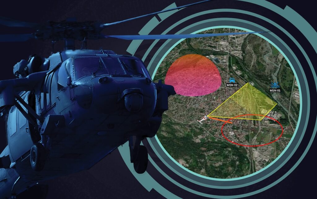

In high-stakes missions where real-time intelligence is critical, FlySight knows that helicopter pilots and operators rely on advanced sensor systems to maintain situational awareness. Read more >>
However, space constraints and cockpit complexity have traditionally limited the integration of additional software and monitoring tools. Today, remote sensing technology (RST) is redefining aerial operations, offering unparalleled insight into terrain, environmental conditions, and mission-specific threats.
At the forefront of this evolution is geo-remote sensing, a sophisticated approach that combines optical remote sensing with enhanced reality solutions.
Understanding Wide-Area Remote Sensing
Remote sensing technology enables operators to acquire critical data about their surroundings without physical interaction. By measuring reflected and emitted radiation, it provides accurate imagery and topographical details in real-time.
This capability is particularly valuable in helicopter operations, where rapid data collection and processing are crucial for decision-making in dynamic environments.
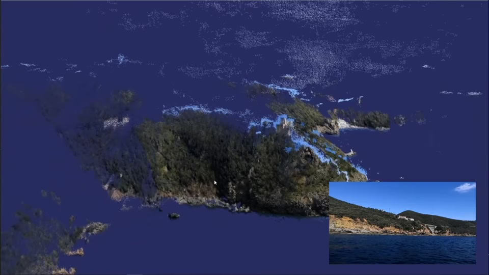
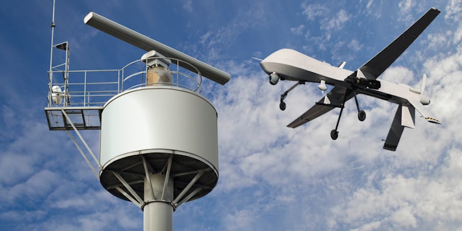
Wide-area remote sensing extends this capability across vast geographic regions, utilizing aerial platforms such as helicopters to gather, analyze, and relay data instantaneously. Technologies such as LiDAR, Synthetic Aperture Radar (SAR), and interferometry SAR (InSAR) are key components of this advanced system, enabling precise mapping and environmental monitoring.
Differentiating Remote Sensing Technologies
While hyperspectral imaging and geospatial technologies are often grouped under remote sensing, their applications and functionalities differ. Hyperspectral imaging operates across a broad spectral range, capturing extensive data for complex analysis.
However, this can sometimes compromise image clarity due to excess background noise. In contrast, multispectral optical remote sensing focuses on specific spectral bands, producing higher-resolution images with enhanced detail.
Geospatial technology, which includes Geographic Information Systems (GIS) and Global Positioning Systems (GPS), complements remote sensing by integrating spatial data for mapping and analysis.
This synergy allows for a more comprehensive understanding of both land-based and maritime environments, enhancing mission effectiveness across various operational landscapes.
The Role of Geo-Remote Sensing in Helicopter Operations
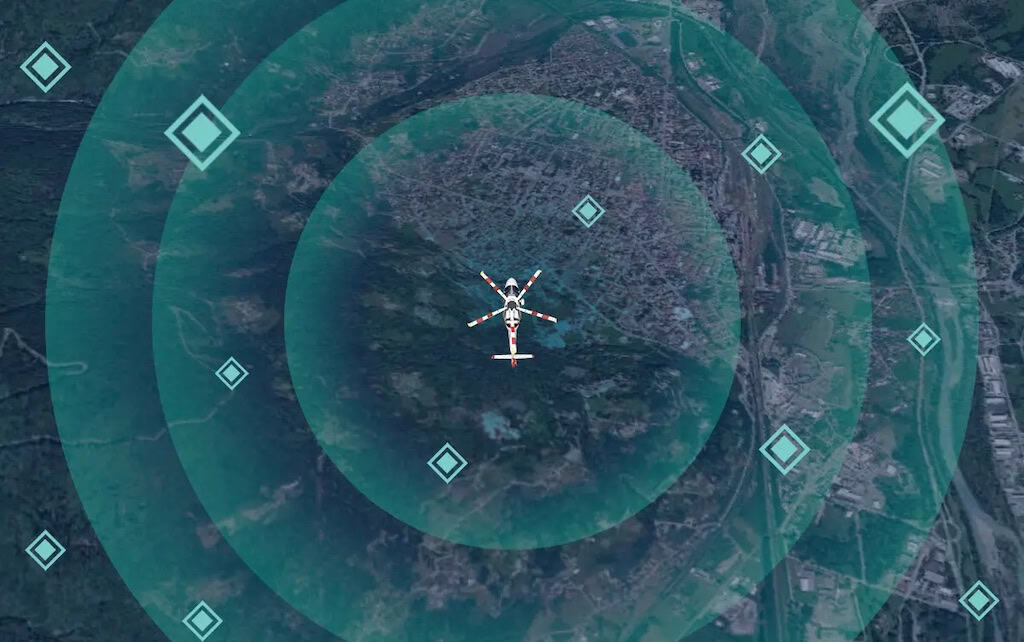
Geo-remote sensing is a critical enabler of mission success in both military and civilian helicopter applications. The technology’s ability to generate high-resolution terrain maps, monitor environmental changes, and track objects in real-time makes it indispensable for search and rescue (SAR), law enforcement, and defense operations.
For optimal performance, remote sensing equipment must balance altitude with resolution quality. While geostationary orbit sensors provide broad coverage, their extreme distance from Earth limits resolution capabilities.
Low-altitude platforms, such as helicopters, deliver superior image quality and real-time data acquisition, ensuring operators receive the most relevant and actionable intelligence.
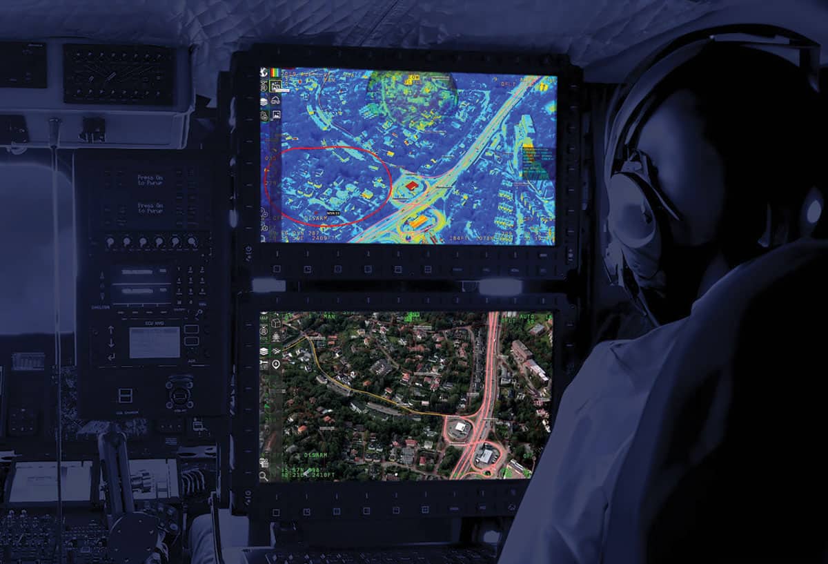
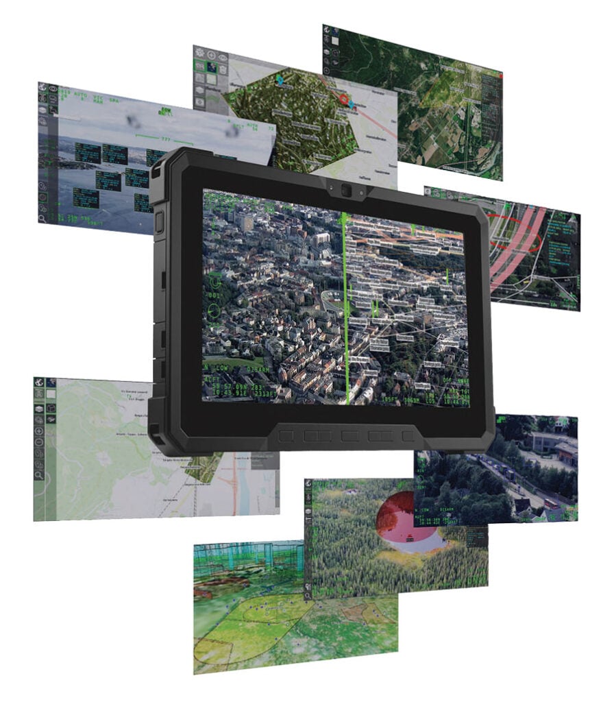
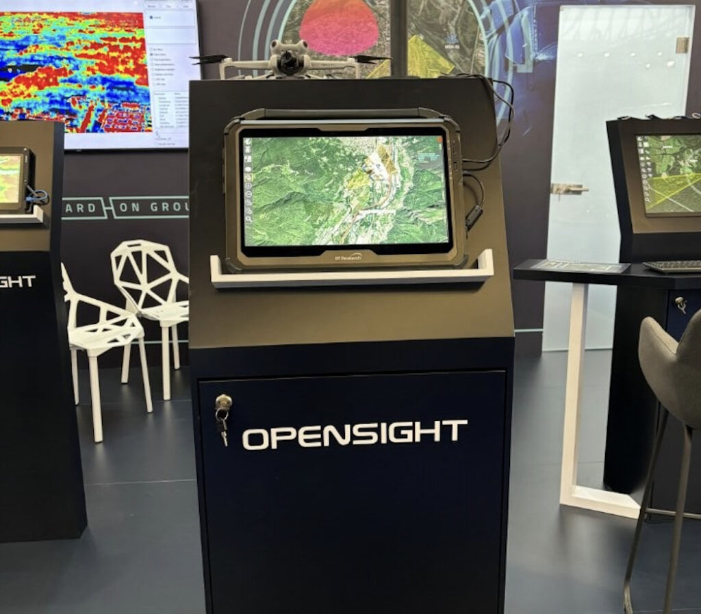
FlySight’s OPENSIGHT System: A Game-Changer in Tactical Flight Operations
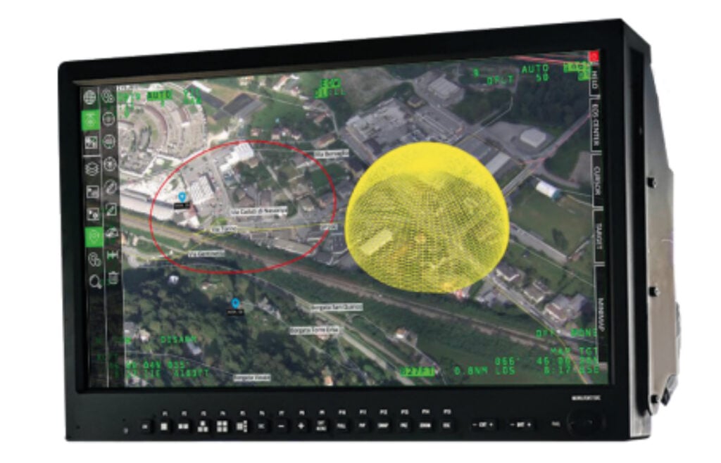
FlySight’s OPENSIGHT system represents a breakthrough in optical remote sensing, integrating multispectral imaging, AI-driven enhancements, and real-time data processing. Designed for seamless integration into helicopter mission consoles, OPENSIGHT enhances situational awareness through features such as:
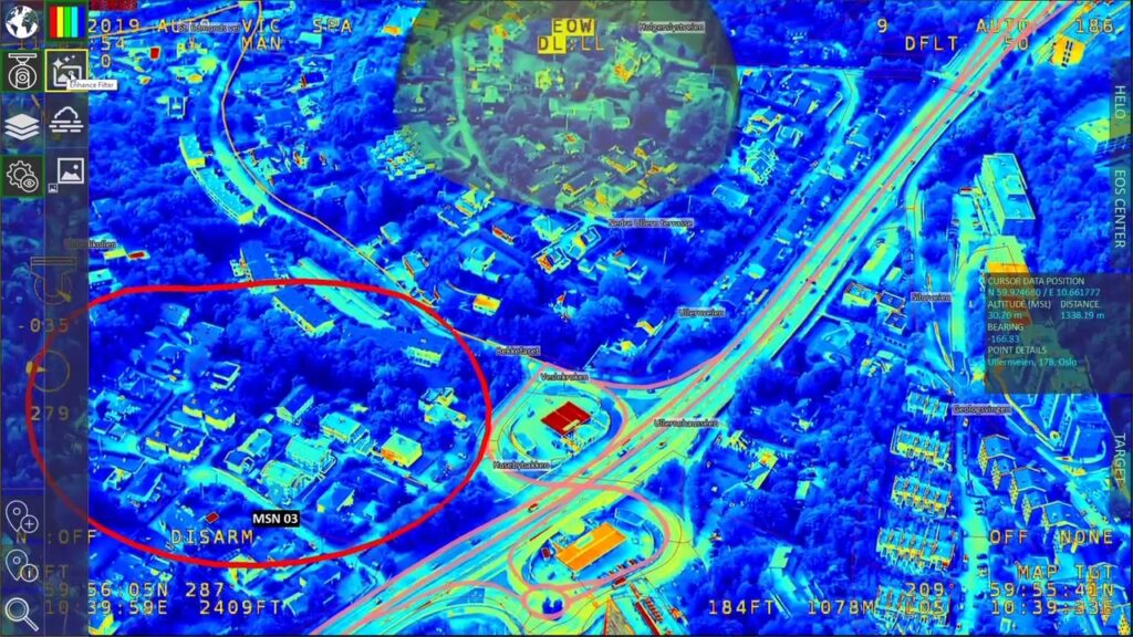
- AI-Powered Image Processing – Utilizing dehazing, Fog Suppression Retinex technology, and image stabilization to improve visual clarity in challenging conditions.
- Georeferencing and Push-Broom Data Analysis – Enabling precise location tracking and enhanced environmental mapping.
- Optimized User Interface – Reducing cockpit workload by presenting only mission-critical data, minimizing distractions for Tactical Flight Officers (TFOs).
By leveraging AI and Enhanced Reality overlays, OPENSIGHT enables pilots and operators to focus on flight performance while the system autonomously processes and analyzes visual data. This reduces cognitive load, allowing personnel to dedicate their attention to mission execution.
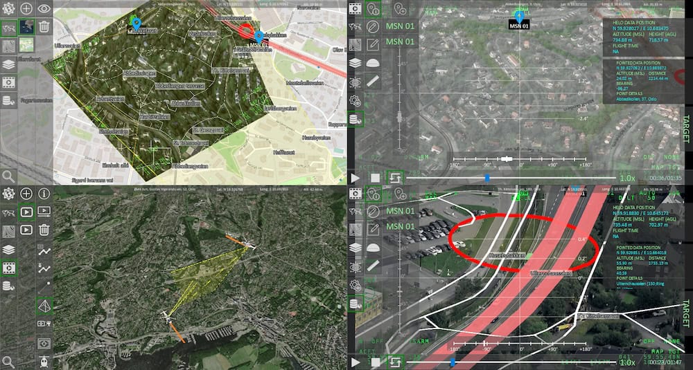
Mission Console Integration: Streamlining Avionic Data Management
OPENSIGHT’s Mission Console is designed for seamless integration with existing avionic systems, consolidating data from radar, GPS, and other onboard sensors. This unified approach enhances navigation, communication, and operational safety by ensuring that mission-critical data is presented in an accessible and user-friendly format.
One of the latest advancements within OPENSIGHT’s Mission Console is the Terrain Above Elevation (TAE) capability, a major safety feature that enhances terrain awareness and obstacle avoidance. By overlaying optical sensor data with real-time elevation mapping, TAE provides pilots with critical insights into potential flight hazards, significantly improving operational safety.
The Future of Remote Sensing in Helicopter Operations
As technology continues to advance, remote sensing solutions like OPENSIGHT will play an increasingly vital role in aerial operations. The integration of AI, multispectral imaging, and real-time data processing is transforming how pilots, law enforcement, and military personnel navigate complex environments.
By delivering high-resolution imagery, enhanced terrain analysis, and intelligent automation, geo-remote sensing is not just an operational enhancement—it is a mission-critical necessity. FlySight’s OPENSIGHT system exemplifies this evolution, providing helicopter operators with the tools they need to execute missions with greater precision, efficiency, and safety.
Read the original article, or visit the FlySight website for more information.