New LiDAR Systems for US DoD Explosive Ordnance Disposal Technicians

RedTail LiDAR Systems' RTL-450 enables Explosive Ordnance Disposal teams to address their 3D terrain mapping needs, calculate crater volumes from improvised explosive device blasts, and perform route and mission planning By DA Staff / 08 Oct 2021

LiDAR

Discover cutting-edge solutions from leading global suppliers
SUPPLIER SPOTLIGHT
RedTail LiDAR Systems RTL-450
Follow DA

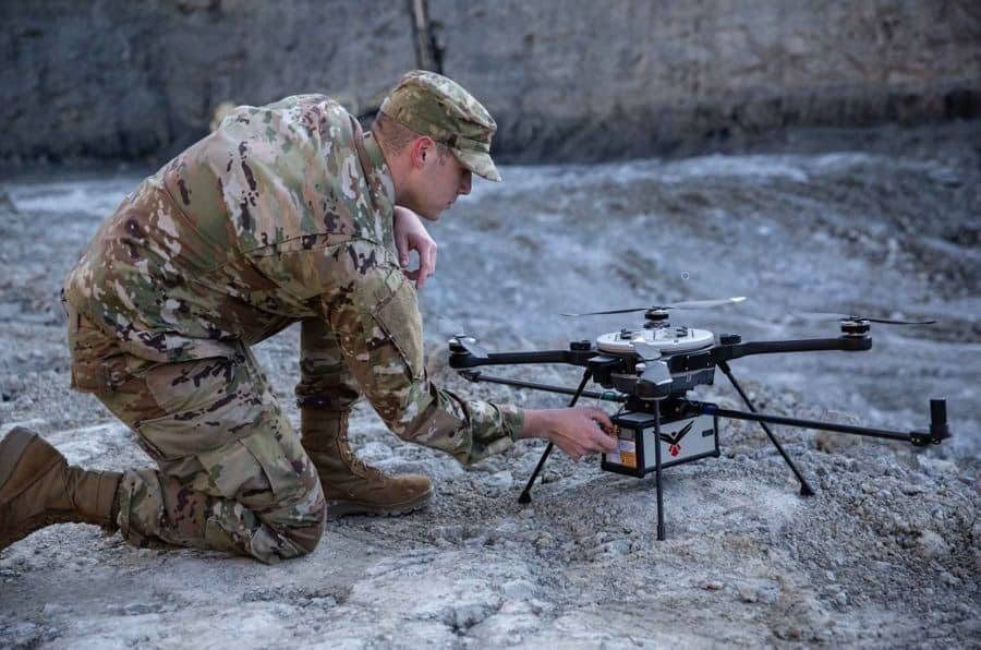
RedTail LiDAR Systems has delivered six Light Detection And Ranging (LiDAR) systems to the 707th Ordnance Company stationed at Joint Base Lewis-McChord in order to provide Explosive Ordnance Disposal (EOD) technicians an opportunity to assess how LiDAR can be used to enhance their operations. 

The RedTail LiDAR Systems RTL-450 was integrated onto the Teledyne FLIR SkyRaider Unmanned Aerial System (UAS) to address a broad range of the EOD community’s 3D terrain mapping needs. 

In addition to mapping, the RTL-450 can be used to calculate crater volumes from improvised explosive device blasts, perform route planning for Unmanned Ground Vehicles (UGVs), aid in mission planning, and conduct surveillance.  

The 3D maps generated – commonly referred to as point clouds – allow operating areas to be viewed from any perspective using the rotation and zoom capabilities provided within the viewer software. 

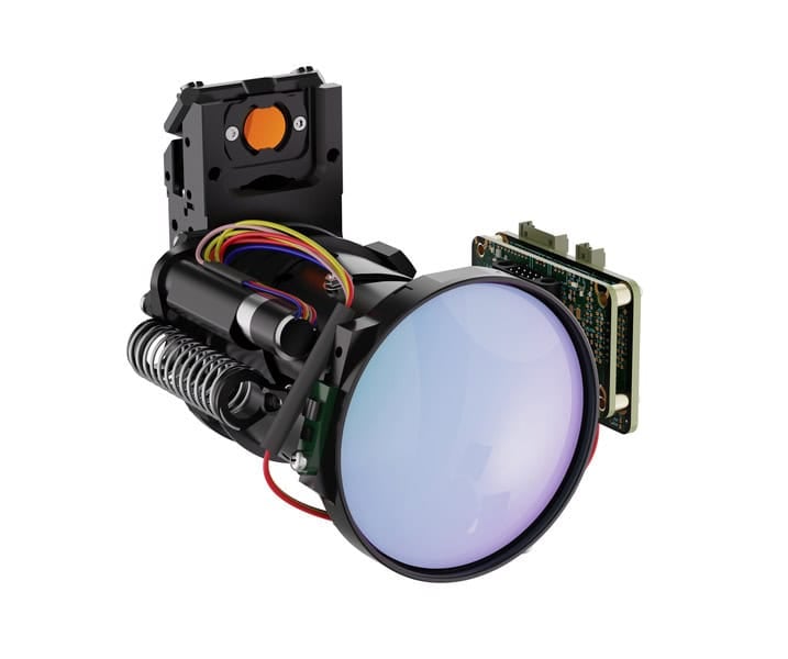
The underlying LiDAR technology used in the RTL-450 was licensed from the Army Research Laboratory (ARL). The Microelectromechanical Systems (MEMS) mirror-based design provides enhanced 3D imagery due to the fact that the laser pulses are steered to the ground in a very well-defined and controlled scan pattern. The LiDAR technology is ideal for applications where Artificial Intelligence and Machine Learning (AI/ML) algorithms can be used for target detection and classification due to the high point density of the point clouds. 

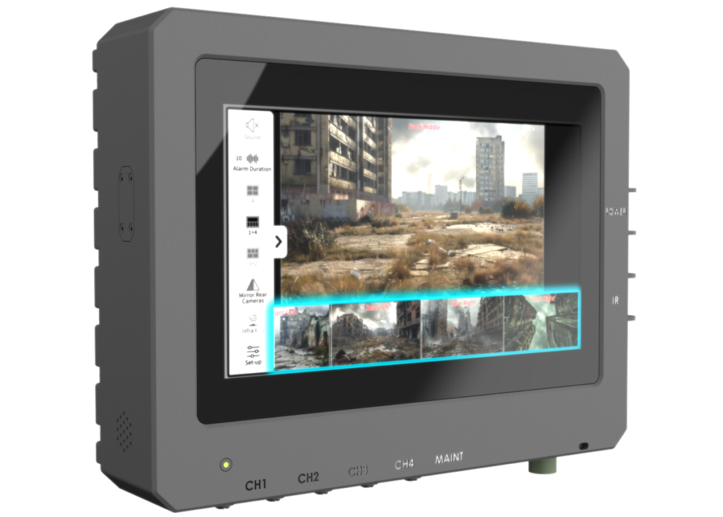
The system can operate in either a raster scan mode for surveillance missions or a side-to-side line scan mode for area mapping while the UAS is flying. The intuitive command and control, high-brightness display integrated into the ground control station, and real time 3D map generation allows operators to begin mission planning and analysis even before the mapping or surveillance missions are completed. 

“Delivering these six LiDAR systems to EOD technicians for test and evaluation is a significant step forward in using MEMS mirror-based LiDAR technology to address a broad range of Department of Defense 3D mapping needs,” said Brad DeRoos, President and CEO of RedTail LiDAR Systems.

“In addition, this delivery represents a true success story in transitioning a technology out of a Department of Defense laboratory and back into the hands of military operators.”  

Posted by DA Staff Connect & Contact

Latest Articles

GA-ASI Invests in Dutch Firms to Advance Defense Innovation After BMN

GA-ASI is set to invest in two Dutch companies following their selection at the Blue Magic Netherlands defense innovation event

Apr 25, 2025
AI-Powered Situational Awareness Platform Launched for Armored Vehicles

Maris-Tech Ltd. has introduced Diamond Ultra, a new integrated AI system designed to improve threat detection and situational awareness in armored fighting vehicles (AFVs)

Apr 25, 2025
Radiofrequency Weapon Disables Drone Swarms in Landmark Army Trial

A UK-developed radiofrequency weapon has successfully downed drone swarms in trials, showcasing a low-cost, high-impact solution to modern aerial threats

Apr 25, 2025
American Standard Circuits’ High-Reliability PCB Services

KT Technical Solutions is highlighting ASC, a vendor and trusted provider of high-performance PCB solutions with a focus on speed, quality, and application-specific expertise

Apr 25, 2025
Q&A with DEFCROS: Key Insights for the 2025 Expo

DEFCROS Founder Kristijan Ilovača discusses the expo’s rapid growth, international ambitions, and how the event aims to support defense and security innovators

Apr 24, 2025
Precision Airdrop System Receives Marketing Approval

ParaZero has received marketing approval from the Israeli Ministry of Defense’s DECA for the DropAir™ Precision Airdrop System, developed in collaboration with Heven Drones

Apr 24, 2025

Featured Content

Q&A with DEFCROS: Key Insights for the 2025 Expo

DEFCROS Founder Kristijan Ilovača discusses the expo’s rapid growth, international ambitions, and how the event aims to support defense and security innovators

Apr 24, 2025
Ophir® FoldIR Lens Enhances Long-Range Imaging for Defense & Security Operations

The new Ophir® FoldIR 25-275mm MWIR zoom lens delivers compact, long-range imaging with low-SWaP performance for drones and small gimbal platforms

Apr 17, 2025
Textron Systems to Support Software & Payload Development for Navy’s MCM USV

Textron Systems is set to support the software development and payload integration for the Navy’s Mine Countermeasures (MCM) Unmanned Surface Vehicle (USV), focusing on future mission capabilities and advanced system integration

Apr 14, 2025
Advancing Defense Capability Through Strategic Collaboration Defense Advancement works with major OEMs to foster collaboration and increase engagement with SMEs, to accelerate innovation and drive defense capabilities forward.